- Product Description Description
- Table of Contents TOC
- List of Table & Figure LOT
- Get Free Sample PDF Sample PDF
Market Size, 2025
$1.13 BnMarket Estimate, 2026
$1.32 BnMarket Forecast, 2034
$4.71 BnCAGR, 2026–2034
17.20%Executive Summary: Asia Pacific Aerial Imaging Market
- Market Scope: Comprehensive regional analysis of the Asia Pacific aerial imaging market covering platform types, application fields, end-use verticals, country-level leadership frameworks, and geospatial intelligence trends.
- Market Valuation: Valued at USD 1.13 billion (2025), estimated at USD 1.32 billion (2026), and projected to reach USD 4.71 billion by 2034, registering a robust CAGR of 17.20% (2026–2034).
- Primary Growth Drivers: Rapid technological advancements in drones, satellites, and aircraft-based imaging systems, coupled with rising demand for geospatial intelligence across urban planning, disaster management, infrastructure development, and precision agriculture. Key opportunities are backed by smart city initiatives and high-resolution imaging requirements.
Key Market Segment Metrics (2026–2034)
| Category | Leading Segment (2025 Position) | Fastest-Growing / Secondary Segment |
|---|---|---|
| By Platform | UAVs / Drones Segment (dominated with 45.4% market share in 2025) | Fixed-Wing Aircraft Segment (projected to record the fastest growth with a 12.5% CAGR) |
| By Application & End-Use | Urban Planning, Infrastructure Monitoring & Precision Agriculture | Smart City Infrastructure & Disaster Response Sectors |
| By Region / Country | China (accounted for the largest market share of approx. 35% in 2025) | India, Japan, South Korea, Australia & Emerging ASEAN Markets |
Major Market Players & Market Structure
Market Structure: Highly competitive regional geospatial and aerial imaging landscape featuring major technology firms and specialized aerial survey providers competing on high-resolution mapping, UAV deployment, and intelligence platforms.
Key Companies: Google Inc., Cooper Aerial Surveys Co., Digital Aerial Solutions (DAS), LLC, EagleView Technologies, Inc., Pictometry International Corp., Fugro, Global UAV Technologies Ltd., Kucera International, Nearmap, Landiscor, and Greenman-Pedersen, Inc.
Asia Pacific Aerial Imaging Market Size
The Asia Pacific aerial imaging market size was valued at USD 1.13 billion in 2025 and is anticipated to reach a valuation of USD 1.32 billion in 2026 and USD 4.71 billion by 2034, growing at a CAGR of 17.20%, from 2026 to 2034.
The Asia Pacific aerial imaging market is driven by rapid technological advancements, along with diverse geographical needs and cross-industry innovation playing a crucial role in revolutionizing how data is captured, as well as interpreted and applied across a wide range of sectors. Aerial imaging involves capturing geospatial data from airborne platforms such as drones, satellites, and aircraft, and also enabling applications in urban planning, along with agriculture, disaster management, and environmental monitoring. The region’s rapid urbanization has led to an increased demand for high-resolution imaging solutions to support infrastructure development and smart city initiatives. Additionally, advancements in drone technology have significantly lowered the cost and complexity of aerial imaging. Australia’s Geoscience Australia emphasizes the use of aerial imaging in natural disaster response, with bushfires and floods driving demand for real-time data collection.
MARKET DRIVERS
Urbanization and Infrastructure Development
Urbanization is a key driver of the aerial imaging market as governments and private entities increasingly rely on geospatial data to plan and manage urban growth. Over $1 trillion is being invested annually in infrastructure projects across the region and many of which require precise aerial imagery for site assessments and progress monitoring. For example, India’s Smart Cities Mission utilizes aerial imaging to create detailed maps for urban planning and transportation networks. Another factor is the rise of smart cities, which depend on aerial imaging for applications like traffic management and utility distribution. Integration of aerial imaging in a smart city framework, where drones capture data to optimize energy usage and reduce emissions.
Agricultural Modernization
The modernization of agriculture is another significant drive, er with aerial imaging enabling precision farming practices. Asia accounts for over 50% of global agricultural production, making it a critical region for technological advancements in farming. In countries like Vietnam, drone-based imaging is used to monitor crop health and optimize irrigation systems, which reduces water usage by up to 30%. Similarly, Australia’s Department of Agriculture emphasizes the role of aerial imaging in livestock management, where drones track animal movements and assess pasture conditions.
MARKET RESTRAINTS
Regulatory Challenges
Regulatory hurdles pose a significant restraint to the aerial imaging market, particularly concerning airspace restrictions and privacy concerns. The International Civil Aviation Organization states that many countries in the region have stringent regulations governing drone operation, limiting their use for commercial purposes. South Korea’s Ministry of Land, Infrastructure, and Transport mandates strict no-fly zones around airports and urban areas, complicating aerial imaging projects. Australia’s Privacy Commissioner states that unauthorized aerial imaging can infringe on personal privacy, which also leads to legal disputes and operational delays.
High Initial Costs
The high initial costs associated with aerial imaging equipment and software also act as a restraint. The Federation of Indian Chambers of Commerce and Industry notes that small and medium enterprises (SMEs) often struggle to afford advanced imaging solutions despite their potential benefits. High-resolution cameras and LiDAR systems can cost several thousand dollars, deterring smaller players from entering the market. Only 20% of businesses have access to trained professionals capable of leveraging aerial imaging technologies.
MARKET OPPORTUNITIES
Integration with AI and Machine Learning
The integration of artificial intelligence (AI) and machine learning (ML) presents a transformative opportunity for the aerial imaging market. AI-driven analytics can process vast amounts of geospatial data to generate actionable insights, enhancing decision-making across industries. AI-powered imaging solutions could generate economic value of up to $1.5 trillion annually in the Asia Pacific region by 2030. Use of AI in disaster management, where aerial imaging combined with ML algorithms predicts flood risks and identifies affected areas in real time. Similarly, China’s National Development and Reform Commission emphasizes the role of AI in urban planning, where drones capture data to optimize land use and reduce congestion.
Expansion into Emerging Economies
Emerging economies in the Asia Pacific offer untapped potential for aerial imaging driven by industrialization and infrastructure development. Drones are used to map remote areas for road construction, which ensures efficient resource allocation. Similarly, Vietnam’s growing manufacturing sector relies on aerial imaging for factory site assessments and supply chain optimization.
MARKET CHALLENGES
Weather and Environmental Constraints
Weather conditions and environmental factors pose significant challenges to the reliability and accuracy of aerial imaging. The Intergovernmental Panel on Climate Change warns that extreme weather events such as typhoons and monsoons disrupt drone operations and compromise data quality. For instance, the Philippines experiences an average of 20 typhoons annually, limiting the feasibility of aerial imaging during certain periods. Additionally, dense vegetation and hilly terrains in countries like Malaysia and Indonesia complicate data capture, requiring specialized equipment and techniques.
Data Security Concerns
Data security is another critical challenge, particularly in sensitive applications like defense and border surveillance. Unauthorized access to aerial imaging data can lead to breaches of national security, undermining public trust in these technologies. Similarly, India’s Ministry of Defence emphasizes the need for robust encryption protocols to protect classified geospatial information. The lack of standardized cybersecurity measures across the region exacerbates this issue, forcing companies to invest heavily in securing their systems.
REPORT COVERAGE
| REPORT METRIC | DETAILS |
| Market Size Available | 2025 to 2034 |
| Base Year | 2025 |
| Forecast Period | 2026 to 2034 |
| CAGR | 17.20% |
| Segments Covered | By Platform Application, End-users, and Region |
| Various Analyses Covered | Global, Regional & Country Level Analysis, Segment-Level Analysis, DROC, PESTLE Analysis, Porter’s Five Forces Analysis, Competitive Landscape, Analyst Overview of Investment Opportunities |
| Regions Covered | India, China, Japan, South Korea, Australia, New Zealand, Thailand, Malaysia, Vietnam, Philippines, Indonesia, Singapore, and the Rest of APAC |
| Market Leaders Profiled | Google Inc., Cooper Aerial Surveys Co., Digital Aerial Solutions (DAS), LLC, EagleView Technologies, Inc. and Pictometry International Corp., Fugro, Global UAV Technologies Ltd, Kucera International, Nearmap, Landiscor, Greenman-Pedersen, Inc. |
SEGMENTAL ANALYSIS
By Platform Insights
The AVs segment dominated the Asia Pacific aerial imaging market by capturing 45.4% of the share in 2025. The growth of the segment is driven by their versatility, cost-effectiveness ability to capture high-resolution imagery in challenging terrains. One major factor is the widespread adoption of drones in agriculture and disaster management. Vietnam’s Ministry of Agriculture states that UAV-based imaging has reduced water usage by up to 30% in rice cultivation. Similarly, Australia’s Geoscience Australia reports that drones are deployed during bushfires to assess damage and plan recovery efforts and further boosting demand. Another factor is the regulatory support for commercial drone operations. Over 1.2 million commercial drones were registered in 2022, reflecting relaxed regulations and incentives for UAV adoption.
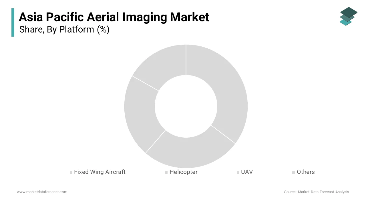
The fixed-wing aircraft segment is projected to witness a CAGR of 12.5% during the forecast period. The growth of the segment is fueled by its use in large-scale geospatial mapping and environmental monitoring projects. A key factor is the expansion of smart city initiatives. Japan’s Ministry of Land, Infrastructure, Transport, and Tourism emphasizes the use of fixed-wing aircraft to create detailed maps for urban planning and transportation networks. Similarly, India’s Smart Cities Mission utilizes these platforms to monitor infrastructure development. Another factor is the growing focus on renewable energy projects. The International Renewable Energy Agency states that fixed-wing aircraft are integral to wind farm site assessments and solar panel inspection, particularly in countries like Australia and South Korea.
By Application Insights
The geospatial mapping segment was the largest in the Asia Pacific aerial imaging market by capturing 30.3% of the share in 2025, with urbanization and infrastructure development. One key factor is the rise of smart cities, which rely on geospatial data for efficient land-use planning. Japan’s Ministry of Economy, Trade, and Industry states that the integration of geospatial mapping in smart city frameworks to optimize energy usage and reduce emissions. Another factor is the growing demand for natural resource management. Australia’s Department of Agriculture emphasizes the use of geospatial mapping to monitor soil health and water resources.
The Disaster management segment is likely to experience a CAGR of 14.2% during the forecast period. This growth is fueled by the increasing frequency of natural disasters in the region. A significant factor is the need for real-time data during emergencies. The Intergovernmental Panel on Climate Change warns that extreme weather events such as typhoons and floods are expected. The Philippines experiences an average of 20 typhoons annually, with aerial imaging playing a crucial role in assessing damage and planning recovery efforts.
By End Use Insights
The government sector accounted in holding 28.7% of the Asia Pacific aerial imaging market share in 2025. One major factor is the expansion of smart city initiatives. India’s Ministry of Housing and Urban Affairs emphasizes the use of aerial imaging to create detailed maps for urban planning and transportation networks. Another factor is the growing focus on disaster management. Governments deploy aerial imaging during bushfires and floods to assess damage and plan recovery efforts.
The agriculture and forestry segment is deemed to grow with a CAGR of 13.8% during the forecast period. This growth is fueled by the modernization of farming practices and sustainable forest management. A key factor is the adoption of precision farming techniques. Drones are increasingly used in agriculture for monitoring crops and optimizing irrigation, contributing to over 50% of global agricultural production. For instance, Vietnam’s Ministry of Agriculture states that UAV-based imaging has reduced water usage by up to 30% in rice cultivation. Another factor is the focus on sustainable forestry. Indonesia’s Ministry of Environment and Forestry emphasizes the use of aerial imaging to monitor deforestation and assess carbon emissions that align with global sustainability goals.
COUNTRY ANALYSIS
Top Leading Countries in the Market
China Aerial Imaging Market Analysis
China was the top performer in the Asia Pacific aerial imaging market and accounted for 35% of the regional share due to its status as a global leader in drone manufacturing and technology innovation. The Civil Aviation Administration of China reports that over 1.2 million commercial drones were registered in 2022, reflecting the country’s robust adoption of UAVs for applications ranging from agriculture to urban planning. China’s Belt and Road Initiative promotes infrastructure development across Asia, which is creating demand for aerial imaging solutions.
India Aerial Imaging Market Analysis
India was positioned second in holding the dominant share of the Asia Pacific aerial imaging market. The country’s rapid urbanization and focus on smart city initiatives drive aerial imaging adoption. The Ministry of Housing and Urban Affairs reports that over 100 smart cities are being developed, with aerial imaging essential for creating detailed maps and optimizing land use. Furthermore, India’s agricultural sector increasingly relies on drones for crop monitoring and irrigation optimization by ensuring steady growth in demand.
Japan Aerial Imaging Market Analysis
Japan's market growth is driven by its advanced technological capabilities and a strong emphasis on disaster management. The Ministry of Land, Infrastructure, Transport, and Tourism emphasizes the use of aerial imaging in smart city frameworks to optimize energy usage and reduce emissions. Additionally, Japan’s frequent earthquakes and typhoons necessitate real-time data collection with aerial imaging, which is playing a critical role in disaster response and recovery efforts.
South Korea Aerial Imaging Market Analysis
South Korea's market growth is driven by its robust electronics and defense industries. The Ministry of Public Safety and Security emphasizes the use of aerial imaging for disaster management, where drones predict flood risks and identify affected areas. Additionally, South Korea’s military sector is increasingly adopting UAVs for surveillance and border monitoring, which further boosts the demand.
Australia Aerial Imaging Market Analysis
Australia's Asia Pacific aerial imaging market is likely to have the fastest growth opportunities in the coming years. Drones are used to monitor soil health and water resources, ensuring sustainable farming practices. Additionally, Geoscience Australia emphasizes the role of aerial imaging in bushfire response, where UAVs assess damage and plan recovery efforts.
COMPETITIVE LANDSCAPE
The Asia Pacific aerial imaging market is characterized by intense competition with both global giants and regional players vying for dominance. Global leaders like DJI, Trimble, and Hexagon leverage their technological expertise and extensive distribution networks to maintain their stronghold. Meanwhile, regional players focus on cost-effective solutions and localized services to cater to price-sensitive markets. The competitive landscape is further shaped by rapid technological advancement, with companies striving to integrate AI, IoT, and cloud-based platforms into their offerings. Additionally, stringent regulatory frameworks governing drone operations have compelled manufacturers to innovate continuously. Supply chain disruptions and raw material price volatility add complexity and forcing players to adopt agile strategies.
KEY MARKET PLAYERS
These are the market players that are dominating the Asia Pacific aerial imaging market, including.
- Google Inc.
- Cooper Aerial Surveys Co
- DJI (Dà-Jiāng Innovations)
- Digital Aerial Solutions (DAS)
- LLC
- Trimble Inc.
- Hexagon AB
- EagleView Technologies, Inc
- Pictometry International Corp.
- Fugro
- Global UAV Technologies Ltd
- Kucera International
- Nearmap
- Landiscor
- Greenman-Pedersen, Inc
Top Players In the Market
- DJI is a global leader in drone technology and aerial imaging with a significant presence in the Asia Pacific market. The company’s contribution to the global market lies in its innovative UAV platform, which is widely used for applications such as agriculture, disaster management, and urban planning. DJI’s focus on affordability, in addition to reliability and ease of use, has positioned it as a preferred partner for businesses and governments seeking scalable aerial imaging solutions. Its cutting-edge technologies, including high-resolution cameras and AI-driven analytics, cs enable precise data collection and analy, sis ensuring long-term value for customers.
- Trimble Inc. plays a pivotal role in advancing geospatial technologies in the Asia Pacific region and is known for its expertise in GPS and mapping solutions. Trimble provides aerial imaging systems that are integral to industries such as construction, agriculture, and energy. The company’s focus on integrating IoT and cloud-based platforms will enhance operational efficiency and real-time monitoring capabilities. Trimble continues to expand its footprint, contributing significantly to global advancements in aerial imaging and data analytics.
- Hexagon AB is renowned for its commitment to smart digital reality solutions, making it a key player in the Asia Pacific aerial imaging market. The company’s advanced imaging platforms enable intelligent data capture and analysis, which empower businesses to optimize resource management and reduce downtime. Hexagon’s dedication to innovation and customer-centric solutions has strengthened its global reputation. Hexagon ensures sustainable growth while driving technological transformation in industries such as urban planning and disaster management.
Top Strategies Used by Key Players in the Market
Strategic Partnerships and Collaborations
Key players in the market frequently engage in partnerships with local government, along with research institutions and industry stakeholders, to co-develop tailored solutions. These collaborations help companies address specific regional challenges such as disaster management and urbanization.
Product Innovation and Customization
To meet the dynamic needs of end-users, companies invest heavily in R&D to introduce innovative and customized products. For instance, manufacturers are developing smart aerial imaging platforms equipped with AI and machine learning capabilities to support predictive analytics and real-time decision-making. This focus on innovation not only differentiates brands but also aligns with the growing demand for sustainable and efficient solutions in the region.
Expansion into Emerging Markets
Players are increasingly targeting emerging economies within the Asia Pacific region, such as Vietnam, Indonesia, and Thailand, where industrialization and infrastructure development are driving demand. By establishing local manufacturing facilities and a distribution network, many companies aim to reduce costs and improve accessibility. This strategy allows them to capture untapped opportunities and strengthen their presence in high-growth markets.
RECENT MARKET NEWS
- In April 2024, DJI launched a new series of drones specifically designed for agricultural applications in India.
- In June 2023, Trimble Inc. partnered with a leading Australian utility provider to supply advanced aerial imaging solutions for water resource management.
- In September 2023, Hexagon AB acquired a local geospatial technology firm in Vietnam to expand its production capabilities for cost-effective aerial imaging platforms.
- In January 2024, SenseFl, a subsidiary of Parrot Group, introduced a line of fixed-wing aircraft tailored for large-scale mapping projects in Japan.
- In November 2023, Autel Robotics signed an agreement with a South Korean defense agency to develop specialized UAVs for surveillance and border monitoring.
MARKET SEGMENTATION
This research report on the Asia Pacific aerial imaging market is segmented and sub-segmented into the following categories.
By Platform
- Fixed Wing Aircraft
- Helicopter
- UAV
- Others
By Application
- Geospatial Mapping
- Disaster Management
- Energy and Resource Management
- Surveillance and Monitoring
- Urban Planning
- Others
By End Use
- Government
- Military and Defense
- Energy
- Agriculture and Forestry
- Civil Engineering
- Media and Entertainment
- Commercial
- Others
By Country
- India
- China
- Japan
- South Korea
- Australia
- New Zealand
- Thailand
- Malaysia
- Vietnam
- Philippines
- Indonesia
- Singapore
- Rest of APAC