- Product Description Description
- Table of Contents TOC
- List of Table & Figure LOT
- Get Free Sample PDF Sample PDF
Market Size, 2025
$748 MnMarket Estimate, 2026
$832 MnMarket Forecast, 2034
$1,951 MnCAGR, 2026–2034
11.24%Executive Summary: Europe GPS Market
- Market Scope: Comprehensive European GPS market analysis covering deployment types, application verticals, regional leadership frameworks, and geospatial technology adoption metrics.
- Market Valuation: Valued at USD 748.17 million (2025), estimated at USD 832.26 million (2026), and projected to reach USD 1,951.40 million by 2034, registering a robust CAGR of 11.24% (2026–2034).
- Primary Growth Drivers: Intelligent transport systems, precision agriculture, 5G integration, emergency location services, autonomous mobility, and geofencing. Key technical and operational highlights include GPS-assisted auto-steering reducing field-operation overlap by up to 15%, EUR 220 million allocated in 2025 for GPS-integrated soil and crop monitoring systems, and over 1,200 GPS signal-loss or degradation incidents reported in European commercial aviation during 2025.
Key Market Segment Metrics (2026–2034)
| Category | Leading Segment (2025 Position) | Fastest-Growing Segment |
|---|---|---|
| By Deployment | Smartphones and Tablets (dominated with 48.3% of the European market share in 2025) | Wearable GPS Devices (projected to register the fastest CAGR of 13.6%) |
| By Application | Road Applications (led with a 41.3% share in 2025, affecting over 5 million heavy goods vehicles) | Location-Based Services (forecast to grow at a strong 14.2% CAGR) |
| By End User / Vertical | Automotive & Transportation Sector (retaining primary commercial volume for road transport and logistics) | Precision Agriculture & Autonomous Mobility Sectors |
| By Region / Country | Germany (led the European market with a 22.3% share in 2025, with >70% of large arable operations in Lower Saxony and Bavaria using GPS machinery) | Advanced European tech-adopting regional markets expanding multi-constellation GNSS infrastructure |
Major Market Players & Market Structure
Market Structure: Highly competitive European GNSS and location-tracking landscape featuring leading global semiconductor firms, geospatial tech providers, and navigation giants competing intensely on multi-constellation and multi-frequency GNSS receivers, sensor fusion, secure positioning, and high-accuracy geospatial services.
Key Companies: Hexagon AB, Qualcomm Inc., Broadcom Inc., Trimble Inc., Garmin Ltd., KVH Industries Inc., United Technologies Corporation (Rockwell Collins Inc.), TomTom N.V., Geotab Inc., and MiTAC Holdings Corporation.
Europe GPS Market Size
The Europe GPS market size was valued at USD 748.17 million in 2025 and is projected to reach USD 1,951.40 million by 2034 from USD 832.26 million in 2026, growing at a CAGR of 11.24%.
The Global Positioning System (GPS) in the European context refers to satellite-based positioning, navigation, and timing (PNT) technologies that enable precise geolocation and synchronisation across transportation, agriculture, defence, logistics, and public infrastructure. According to the European GNSS Agency, location-based services in the European Union in 2025 utilised a hybrid of GPS and Galileo signals to improve reliability and reduce positioning errors.
MARKET DRIVERS
Mandatory Deployment of Intelligent Transport Systems Across EU Member States
The phased implementation of EU-mandated Intelligent Transport Systems (ITS) is a primary factor accelerating the growth of European GPS market. Regulation (EU) 2019/621 requires all new heavy goods vehicles over 3.5 tonnes registered from June 2025 to be equipped with smart tachographs that use GPS to record location data at border crossings and during rest periods. Additionally, the eCall initiative, fully enforced since April 2018, mandates that all new passenger cars automatically transmit GPS coordinates to emergency services during crashes. Urban mobility policies further amplify demand, where cities like Paris and Berlin now require ride-hailing and micromobility operators to share real-time GPS telemetry with municipal traffic management centres to optimise congestion pricing and fleet redistribution. These regulatory imperatives transform GPS from an optional feature into a legally embedded component of Europe’s transport ecosystem.
Expansion of Precision Agriculture and EU Common Agricultural Policy Reforms
The modernisation of farming through precision agriculture in rural economies is additionally leveraging the growth of the European GPS market. The farmers receiving EU subsidies must demonstrate compliance with environmental standards such as buffer zone maintenance and reduced chemical application, tasks that rely on GPS-enabled machinery for accurate field mapping and variable rate technology. According to the European Commission’s Directorate General for Agriculture, arable farmland in Germany, France and the Netherlands used GPS-guided equipment for seeding and spraying in 2025. The Joint Research Centre further estimated that GPS-assisted auto steering reduced overlap in field operations by up to 15 % by translating into substantial fuel and input savings. Moreover, the EU’s Farm to Fork Strategy promotes digital farming tools, with the European Innovation Partnership allocating 220 million euros in 2025 to support GPS-integrated soil and crop monitoring systems.
MARKET RESTRAINTS
Vulnerability to Signal Jamming and Spoofing in Critical Infrastructure
The growing susceptibility of civilian GPS signals to intentional interference, particularly near conflict zones and critical transport corridors, is restricting the growth of the European GPS market. GPS operates on unencrypted L1 and L2 frequencies by making it prone to jamming from low-cost devices that disrupt positioning accuracy. According to the European Union Aviation Safety Agency, over 1200 incidents of GPS signal loss or degradation were reported by commercial aircraft operating in European airspace during 2025, primarily near the Baltic and Eastern European regions. While Galileo offers authentication features through its Open Service Navigation Message Authentication, full deployment remains incomplete.
Dependence on Non-European Satellite Constellations and Limited Sovereign Control
Europe’s continued reliance on the U.S.-operated GPS constellation, despite the existence of Galileo,o on strategic autonomy and system resilience is another restraining factor for the growth of Europe's GPS market. Although Galileo provides independent positioning, most consumer and commercial devices in Europe still default to GPS due to legacy compatibility and chipset design preferences. This dependence means Europe cannot guarantee signal availability or integrity during geopolitical crises, as the U.S. Department of Defence retains authority to degrade or deny GPS access in specific regions. While the EU is investing in Galileo Second Generation satellites with enhanced anti-jamming capabilities, full operational sovereignty is not expected before 2030.
MARKET OPPORTUNITIES
Integration of GPS with 5G and Location-Based Emergency Services
The integration of GPS with next-generation 5G networks is unlocking high-precision location services for public safety and smart city applications across Europe. Under the EU’s Radio Equipment Directive updated in 2023, all 5G capable smartphones sold from 2026 must support advanced emergency location features that fuse GPS with cellular and Wi Fi positioning to achieve sub-3 meter accuracy indoors and outdoors. As per the Body of European Regulators for Electronic Communications, this requirement will cover over 200 million mobile devices annually by 2026. The European Emergency Number Association confirmed that trials in Finland and Austria in 2025 demonstrated a 50% improvement in emergency response times using hybrid GPS 5G location data. Furthermore, 5G network slicing enables dedicated location channels for first responders, with GPS providing the foundational geospatial layer. Municipalities are also leveraging this synergy for asset tracking; the City of Barcelona deployed GPS-enabled 5 G-connected waste bins that optimise collection routes in real time. This integration transforms GPS from a standalone navigation tool into a core enabler of resilient, responsive, and data-driven urban ecosystems.
Growth of Autonomous Mobility and Geofencing in Shared Transport
The proliferation of shared and autonomous mobility solutions is creating new opportunities for the growth of the European GPS market. E-scooter and bike sharing operators such as Lime and Tier use GPS-based geofencing to enforce no-ride and no-parking zones in over 150 European cities as of 2025, according to the European Cyclists Federation. These virtual boundaries relon y sub-5-meter GPS accuracy to prevent sidewalk riding and illegal parking, with violations triggering automatic service suspension. Simultaneously, autonomous shuttle pilots in cities like Helsinki and Lyon integrate dual frequency GPS with inertial measurement units to maintain lane-level precision without human intervention. As per the European Automobile Manufacturers Association, 82 % of Level 2+ advanced driver assistance systems launched in 2025 use GPS for map matching and curve speed adaptation.
MARKET CHALLENGES
Inadequate Resilience of Civilian GPS Signals in Urban Canyon Environments
GPS effectiveness in Europe is signal degradation in dense urban settings, with the urban canyon effect also degrading the growth of the European GPS market. Tall buildings in cities like London, Milan and Warsaw obstruct the line of sight to satellites, which is causing multipath errors and position drift exceeding 10 meters. This limitation impedes the reliability of location-based services such as emergency dispatch, autonomous delivery robots, and congestion charging, all of which require meter-level accuracy. The European Commission’s Horizon Europe program has funded several projects to develop hybrid positioning using 5G and low-earth orbit signals, but commercial deployment remains years away.
Fragmented Regulatory Framework for Location Data Privacy and Consent
The inconsistent interpretation of location data governance across EU member which is likely to impede the growth of EthTheropean GPS market. While the General Data Protection Regulation provides a baseline, national data protection authorities apply divergent standards to geolocation collection, storage, and third-party sharing. In Germany, continuous GPS tracking of delivery drivers requires explicit works council approval, whereas in Spain, anonymised route data can be used without individual consent. This fragmentation increases legal risk and system design complexity for companies deploying GPS at scale. Moreover, the upcoming EU AI Act classifies real-time location profiling as high risk, demanding rigorous impact assessments.
REPORT COVERAGE
| REPORT METRIC | DETAILS |
| Market Size Available | 2025 to 2034 |
| Base Year | 2025 |
| Forecast Period | 2026 to 2034 |
| CAGR | 11.24% |
| Segments Covered | By Deployment, Application, and Region |
| Various Analyses Covered | Global, Regional, & Country Level Analysis; Segment-Level Analysis; DROC, PESTLE Analysis; Porter’s Five Forces Analysis; Competitive Landscape; Analyst Overview of Investment Opportunities |
| Regions Covered | UK, France, Spain, Germany, Italy, Russia, Sweden, Denmark, Switzerland, Netherlands, Turkey, and the Czech Republic |
| Market Leaders Profiled | Hexagon AB, Qualcomm Inc., Broadcom Inc., Trimble Inc., Garmin Ltd., KVH Industries Inc., United Technologies Corporation (Rockwell Collins Inc.), TomTom N.V., Geotab Inc., and MiTAC Holdings Corporation |
SEGMENTAL ANALYSIS
By Deployment Insights
The smartphones and tablets segment accounted in holding 48.3% of the European GPS market share in 2025, with the near universal integration of GNSS chipsets in mobile devices and their role as primary platforms for location-based services. Every smartphone sold in the EU since 2020 includes support for both GPS and Galileo, with dual frequency reception now standard in mid to high-tier models. Regulatory mandates further entrench this segment, with the EU’s Radio Equipment Regulation requiring all 5G smartphones sold from 2026 to support advanced emergency location using hybrid GPS Galileo positioning. Additionally, the proliferation of mobile banking, contactless payments, and geofenced promotions has made precise location a core utility rather than an ancillary feature.
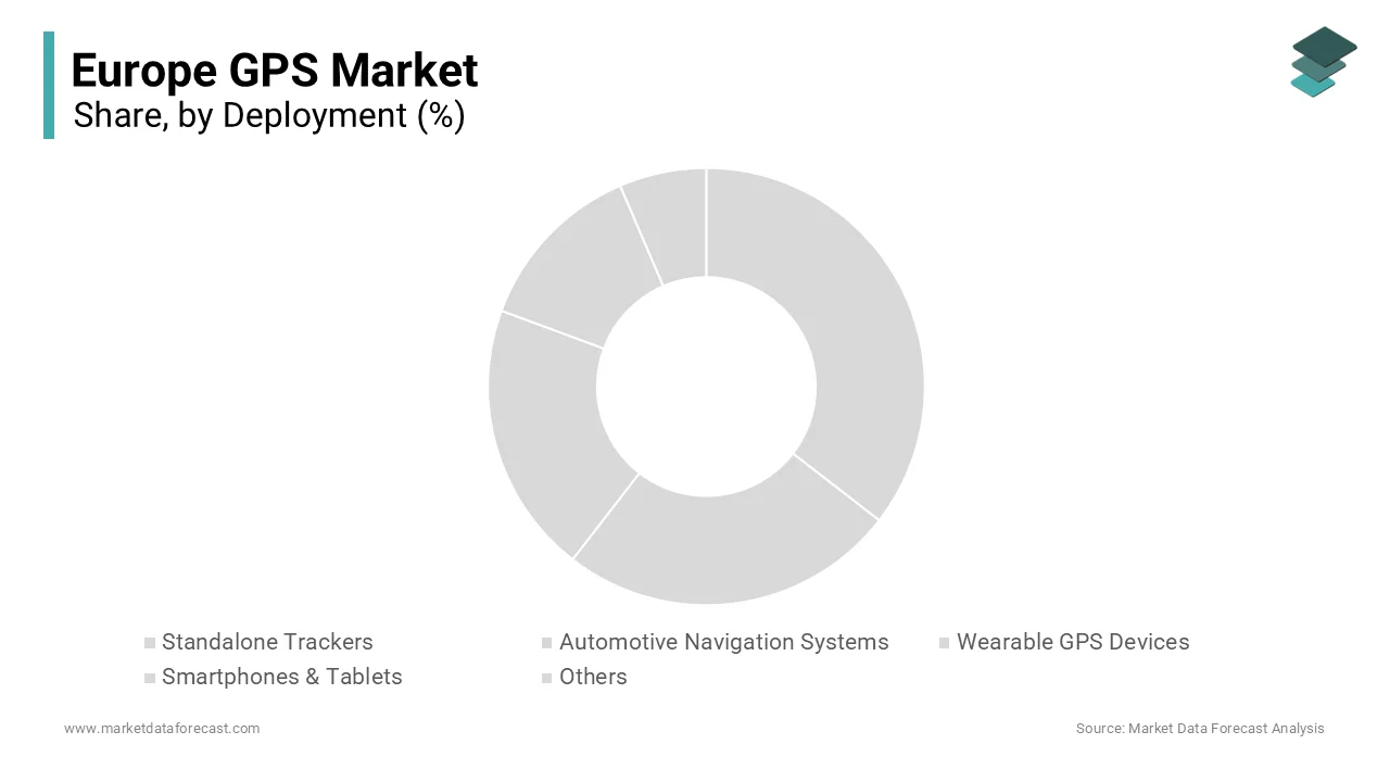
The wearable GPS devices segment is likely to register the fastest CAGR of 13.6% during the forecast period, owing to the rising health consciousness, ageing demographics, and regulatory support for remote patient monitoring. Fitness trackers and smartwatches with standalone GPS now enable accurate route and pace tracking without smartphone tethering, appealing to runners and cyclists across urban and rural Europe. Concurrently, national health systems are piloting wearables for chronic disease management, where the UK’s National Health Service integrated GPS-enabled fall detection alerts from smartwatches into its elderly care program, covering over 120000 users by early 2026. Chipset miniaturisation has also reduced power consumption, with Qualcomm’s latest wearable platform extending GPS battery life to over 20 hours.
By Application Insights
The road application segment held 41.3% of the European GPS market share in 2025, with the continent’s dense road network, high vehicle ownership, and extensive regulatory use of geolocation for safety and compliance. All new passenger cars sold in the EU since 2018 include the eCall system, which automatically transmits GPS coordinates to emergency services during crashes. Additionally, the Digital Tachograph Regulation mandates GPS logging of vehicle location at border crossings for commercial trucks, which is affecting more than 5 million heavy goods vehicles. Urban mobility further amplifies demand, where cities like Amsterdam and Vienna require shared mobility operators to provide real-time GPS feeds for fleet management and geofencing enforcement.
The Location Based Services (LBS) segment is expected to witness a CAGR of 14.2% throughout the forecast period with the deep integration of geolocation into digital commerce, public safety, and smart city infrastructure. Retailers increasingly deploy geofenced mobile promotions. A 2025 study by the European Retail Roundtable found that major fashion and grocery chains in France and Spain used GPS-triggered discounts to drive foot traffic. Emergency services benefit from advanced mobile location that hybrid GPS Wi Fi cellular positioning reduced ambulance dispatch errors by 31 % in pilot cities. Moreover, the EU’s Digital Markets Act now requires large app stores to enable precise location sharing for third-party services, which is fostering innovation in hyperlocal delivery and social networking.
REGIONAL ANALYSIS
Germany Market Analysis
Germany was the top performer of the European GPS market by occupying 22.3% of the share in 2025 with its advanced automotive industry, extensive logistics network, and strong adoption of precision technologies in agriculture and public services. As the home of BMW, Mercedes-Benz, and Volkswagen, Germany integrates high-accuracy GPS into virtually every new vehicle for navigation, driver assistance, and over-the-air updates. In farming, over 70 % of large arable operations in Lower Saxony and Bavaria used GPS-guided machinery for variable rate application. Germany also leads in testing autonomous shuttles in cities like Hamburg and Munich, all dependent on centimetre-level GNSS positioning.
United Kingdom Market Analysis
The United Kingdom's GPS market growth is likely to be driven by the UK maintains deep integration with European GNSS frameworks and its lead in innovative location-based applications across finance, health, and transport. The National Health Service’s rollout of GPS-enabled wearables for elderly fall detection reached over 100000 users by 2025, which is significantly reducing emergency response times. London’s congestion charge and ultra-low emission zone enforcement further depend on automatic number plate recognition fused with GPS trajectory data.
France Market Analysis
The French GPS market is expected to have significant opportunities in next coming years. The nation’s strength lies in its dual focus on sovereign satellite navigation through Galileo participation and widespread civilian adoption across transport and defence. Paris enforces one of Europe’s strictest micromobility regulations, requiring all e-scooter operators to use GPS geofencing to restrict riding in pedestrian zones. In aviation, French air navigation provider DSNA integrated GPS-based Performance Based Navigation into 90 % of domestic terminal procedures by 2025, which is improving fuel efficiency. Furthermore, France’s defence sector deploys encrypted GPS Galileo receivers in armoured vehicles and drones by ensuring operational resilience.
Italy Market Analysis
Italy's GPS market growth is driven by its extensive road transport sector, tourism infrastructure, and maritime logistics. In tourism, cities like Rome and Venice use GPS-enabled crowd monitoring systems to manage visitor flows in historic centres, with real-time data informing dynamic entry pricing. Additionally, precision viticulture is growing in Tuscany and Piedmont, where winemakers use GPS-guided sprayers to minimise chemical use in compliance with EU sustainability directives. These sector-specific implementations reflect Italy’s pragmatic and diversified approach to GPS utilisation.
COMPETITIVE LANDSCAPE
KEY MARKET PLAYERS
Some of the notable key players in the European GPS market are
- Hexagon AB
- Qualcomm, Inc.
- Broadcom, Inc.
- Trimble, Inc.
- Garmin Ltd.
- KVH Industries, Inc.
- United Technologies Corporation (Rockwell Collins, Inc.)
- TomTom N.V.
- Geotab, Inc.
- MiTAC Holdings Corporation
TOP STRATEGIES USED BY THE KEY MARKET PLAYERS
Key players in the European GPS market focus on developing multi-constellation and multi-frequency GNSS receivers to enhance positioning accuracy and resilience. They invest in sensor fusion technologies that combine GPS data with inertial and cellular inputs for urban and indoor environments. Strategic collaborations with automotive original equipment manufacturers and smart city authorities ensure early integration into high-growth applications. Companies also prioritise compliance with European regulations such as the Cyber Resilience Act and Radio Equipment Directive by embedding secure boot and authentication features. Additionally, they expand software-defined correction services and cloud-based location platforms to transform raw positioning into value-added geospatial insights for enterprise customers.
COMPETITION OVERVIEW
The European GPS market features a dynamic mix of specialised GNSS component makers, global semiconductor firms, and geospatial data providers competing across hardware, software, and services. Competition is particularly intense in automotive and precision agriculture, where accuracy, reliability, and regulatory compliance are non-negotiable. European companies liku-bloxox leverage regional proximity to automotive and industrial customers to offer tailored solutions, while global players such as Qualcomm dominate through scale and integration into mobile ecosystems. TomTom and other map data firms compete on freshness and intelligence rather than raw signal reception. The emergence of Galileo has intensified innovation with vendors racing to support authenticated and high-accuracy services.
TOP PLAYERS IN THE MARKET
- U-blox is a Swiss-based global leader in positioning and wireless communication technologies with deep roots in the European GPS and GNSS ecosystem. The company designs and manufactures high-precision GNSS modules, chips, and software that serve automotive, industrial, and consumer applications worldwide. U-blox has been instrumental in advancing multi-constellation support, enabling devices to simultaneously leverage GPS, Galileo and other satellite systems for enhanced accuracy. In 202,4, the company launched its UBX F9 high precision platform featuring real-time kinematic capabilities for autonomous machinery and surveying. It also expanded partnerships with European automotive Tier 1 suppliers to integrate its secure positioning modules into next-generation electric vehicles. These initiatives reinforce u-blox’s role as a key enabler of resilient and accurate location services across Europe and globally.
- Qualcomm plays a pivotal role in the European GPS market through its Snapdragon mobile and automotive platforms that integrate advanced GNSS capabilities. Qualcomm’s recent focus has been on improving urban positioning accuracy through sensor fusion and dual-frequency GNSS. In early 2026, it introduced the Snapdragon Ride Flex SoC featuring integrated safety-certified GNSS for autonomous driving systems compliant with European regulatory standards. The company also collaborates with EU-based telecom operators to enhance location accuracy using 5G and GNSS synergy. These efforts position Qualcomm at the intersection of connectivity and precise positioning in Europe’s evolving mobility and digital infrastructure landscape.
- TomTom is a Dutch technology company renowned for its digital maps navigation software and GNSS-based location services that power automotive and enterprise solutions across Europe and beyond. While not a hardware manufacturer, TomTom’s map data and positioning algorithms are embedded in millions of vehicles and devices globally. The company has significantly invested in its High Definition Maps platform, which combines GPS data with vehicle sensor inputs to support automated driving. It also enhanced its GNSS correction services through collaboration with the European Space Agency to improve positioning accuracy for fleet operators. TomTom’s strength lies in transforming raw GPS signals into actionable geospatial intelligence that drives smarter mobility decisions.
MARKET SEGMENTATION
This research report on the European GPS market has been segmented and sub-segmented based on categories.
By Deployment
- Standalone Trackers
- Automotive Navigation Systems
- Wearable GPS Devices
- Smartphones & Tablets
- Others
By Application
- Road
- Aviation
- Marine
- Location-Based Services
- Surveying & Mapping
- Others
By Country
- UK
- France
- Spain
- Germany
- Italy
- Russia
- Sweden
- Denmark
- Switzerland
- Netherlands
- Turkey
- Czech Republic
- Rest of Europe