Global Geospatial Solutions Market Size, Share, Trends & Growth Forecast Report By Technology (Geospatial Analytics, GNSS & Positioning, Scanning, Earth Observation), Solution Type (Hardware, Software, Service), Application (Planning & Analysis, Asset Management, Surveying & Mapping, Geo-visualization, Others), End-user (Transportation, Défense & Intelligence, Infrastructural Development, Others), & Region - Industry Forecast From 2026 to 2034
Market Size, 2025
$433.28 BnMarket Estimate, 2026
$487.44 BnMarket Forecast, 2034
$1,251 BnCAGR, 2026–2034
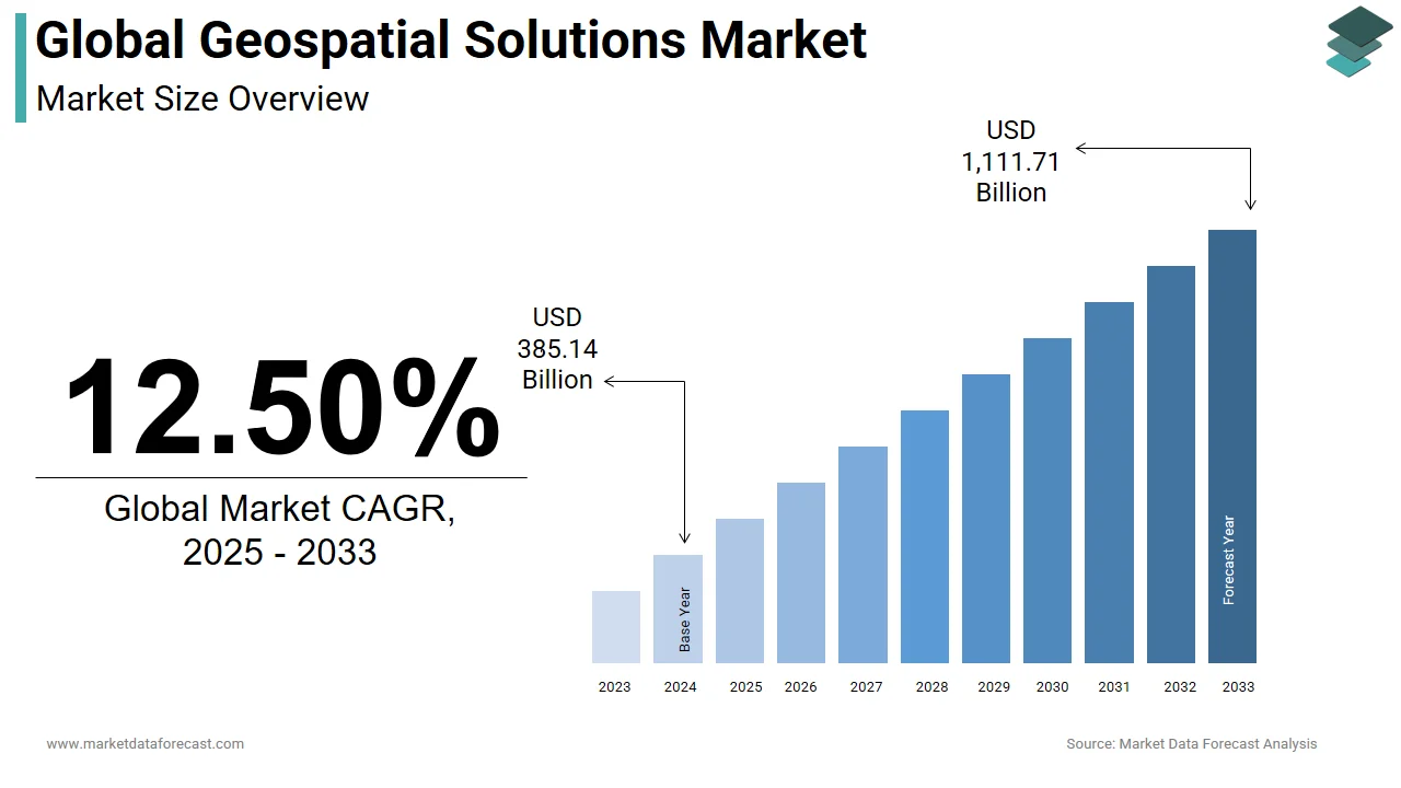
12.50%Global Geospatial Solutions Market Size
The global geospatial solutions market was valued at USD 433.28 billion in 2025. This market is expected to grow at a CAGR of 12.50% from 2026 to 2034, reaching USD 1,251 billion by 2034, up from USD 487.44 billion in 2026.
The rising trend of integrating geospatial systems with traditional processes and releasing solutions is expected to promote market growth. The growing need for innovative technologies in emerging countries and the introduction of the concept of smart cities are projected to increase the market for geospatial solutions. The geospatial solutions market is expected to increase rapidly during the forecast period as the number of GPS-enabled smartphone devices grows.
Geographic Information System (GIS), Global Positioning System (GPS), and Remote Sensing (RS), a technology that enables a totally different way of making and using maps that are needed to govern communities and industries, are all part of the burgeoning field of geospatial technology. We can use geospatial technology to collect georeferenced data for analysis, modeling, simulations, and visualization. Geographic solutions are used to create geospatial data models and solutions across many sectors. They integrate sensors, real-time communications, field apps, field and back-office processing, modeling, and analytics to provide effective workflow, high quality, and data interchange to drive productivity, efficiency, and safety. As a result, you'll have a wealth of correct data to turn into the insight you need to make decisions.
MARKET DRIVERS
Spatial and geographic data are analyzed and studied using geographic information systems (GIS). Integrating technologies such as Augmented Reality (AR), 3D printing, and Artificial Intelligence (AI) into geospatial solutions is expected to drive market expansion. Furthermore, the market is expected to grow as a result of increasing research efforts related to space and the earth and consistent funding for these research activities. Furthermore, the growing adoption of the Global Positioning System (GPS) worldwide is likely to boost market growth.
MARKET RESTRAINTS
Some constraints and hurdles will stymie the overall expansion of the Geospatial Solutions market. Stringent regulatory regulations and legalities may prove to be the source of market growth restraints.
REPORT COVERAGE
| REPORT METRIC | DETAILS |
| Market Size Available | 2025 to 2034 |
| Base Year | 2025 |
| Forecast Period | 2026 to 2034 |
| CAGR | 12.5% |
| Segments Covered | By Technology, Solution Type, Application, End-User, And Region |
|
Various Analyses Covered | Global, Regional & Country Level Analysis, Segment-Level Analysis, DROC, PESTLE Analysis, Porter’s Five Forces Analysis, Competitive Landscape, Analyst Overview on Investment Opportunities |
| Regions Covered | North America, Europe, APAC, Latin America, Middle East & Africa |
|
Market Leaders Profiled | Trimble Inc., Pitney Bowes Inc., Hexagon AB, Maxar Technologies, Harris Corporation, Apple Inc., Amazon Web Services, Inc., IBM, Oracle, SAP, and others. |
SEGMENTAL ANALYSIS
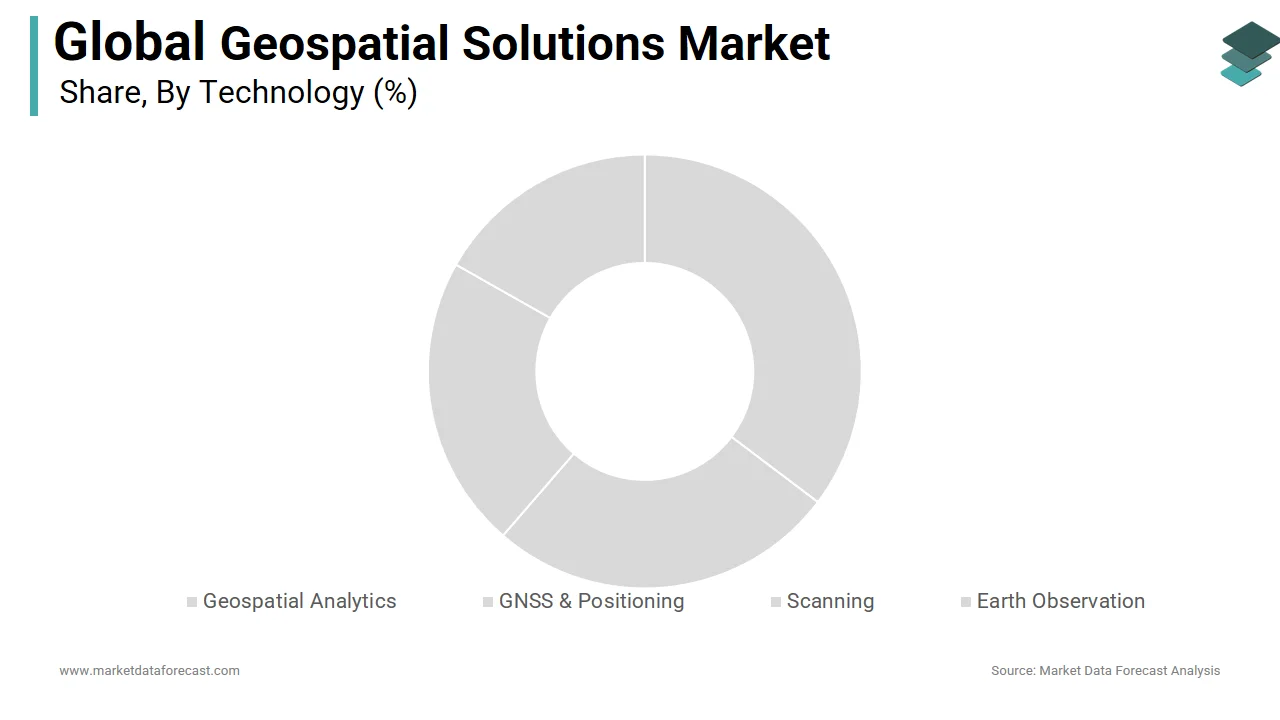
By Technology Insights
The market is divided into Geospatial Analytics, GNSS & Positioning, Scanning, and Earth Observation based on technology. Satellite images, Light Detection and Ranging (LiDAR), and similar technologies have all grown in popularity in recent years. Earth observation satellites track changes in anything from temperature to forestation to ice sheet coverage on the planet. During the projected period, the earth observation sector is expected to dominate the market.
By Solution Type Insights
The market is divided into three categories based on solution type: hardware, software, and service. The introduction of software into the geospatial solution sector has simplified complicated situations. The geospatial-specific software provides a platform that serves as a user interface for executing and analyzing diverse geospatial data. As a result, the software segment accounts for most of the market revenue and has a more significant portion of the geospatial technologies and solutions sector.
By Application Insights
The market is divided into Planning & Analysis, Asset Management, Surveying & Mapping, Geo-visualization, and Others based on application. The greatest segment is surveying and mapping. The surveying and mapping solution market is growing due to an increase in the trend of using technologies such as lidar and remote sensing for data capture. The Planning and Analysis area, on the other hand, is expected to develop at the quickest rate. During the projected period, the market is expected to be driven by growing applications such as telecom, urban planning, transportation planning, environmental planning, and land use planning.
By End User Insights
Transportation, Défense & Intelligence, Infrastructural Development, and Others are the end-user segments of the market. Défense & Intelligence is the most popular segment among end-users, owing to widespread application in both developed and developing countries. However, due to the massive infrastructure operations currently underway, Infrastructural Development will increase rapidly during the projection period.
REGIONAL ANALYSIS
In the past, North America controlled the market. The market in North America is expected to increase due to the growing trend of geospatial technologies being integrated into mainstream technology. The United States is predicted to have the highest consumption of geospatial solutions in the North American region, with a CAGR of 11.7 percent from 2022 to 2027.
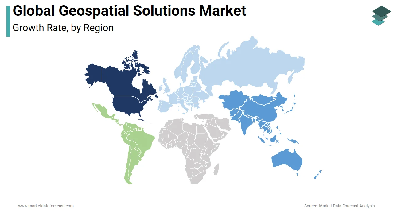
However, due to the quickly increasing technology hub, Asia-Pacific is expected to be the fastest-growing category during the forecast period. With a CAGR of 13.9 percent between 2022 and 2029, China is expected to lead the worldwide geospatial solution market in growth. China has consistently enhanced its military capability in air, land, and sea, fuelling the growth of the geospatial solution market.
The geospatial solution industry in the United Kingdom is estimated to reach a valuation of US$95.7 by 2029. Demand for geospatial solutions in European countries such as the United Kingdom, France, Germany, and others is expected to expand rapidly in the future. This is due to Europe's robust defense and internal security systems and growing urbanization.
Saudi Arabia topped the geospatial analytics market in the Middle East and Africa in 2021, followed by Turkey. The geospatial solution market in the Middle East and Africa is growing due to measures taken by central governments in countries such as Saudi Arabia to examine geospatial imaging and investments made by numerous governments in the region.
The Latin American geospatial analytics industry is growing due to increased government focus and initiatives, such as the creation of a special department to oversee growth and innovation in geospatial imaging and NASA's efforts to provide satellite imagery to Mexico.
KEY MARKET PARTICIPANTS
The major companies operating in the global geospatial solutions market include Trimble Inc., Pitney Bowes Inc., Hexagon AB, Maxar Technologies, Harris Corporation, Apple Inc., Amazon Web Services, Inc., IBM, Oracle, SAP, and others.
RECENT MARKET HAPPENINGS
Satellogic Inc. (NASDAQ: SATL), a leader in collecting sub-meter resolution satellite imagery, has teamed up with Geollect, a global leader in geospatial intelligence and data analysis, to provide unrivaled maritime domain awareness capabilities.
MARKET SEGMENTATION
This research report on the global geospatial solutions market has been segmented and sub-segmented based on the technology, solution type, application, end-user, and region.
By Technology
-
Geospatial Analytics
-
GNSS & Positioning
-
Scanning
-
Earth Observation
By Solution Type
-
Hardware
-
Software
-
Service
By Application
-
Planning & Analysis
-
Asset Management
-
Surveying & Mapping
-
Geo-visualization
-
Others
By End User
-
Transportation
-
Défense & Intelligence
-
Infrastructural Development
-
Others
By Region
-
North America
-
Europe
-
Asia Pacific
-
Latin America
-
Middle East & Africa
Frequently Asked Questions
What are the emerging trends in the global geospatial solutions market?
Emerging trends in the geospatial solutions market include the integration of artificial intelligence (AI) and machine learning (ML) algorithms for data analysis, the adoption of cloud-based geospatial platforms for scalability and accessibility, and the proliferation of location-based services in consumer applications such as ride-hailing and augmented reality gaming.
How are advancements in satellite technology impacting the global geospatial solutions market?
Advances in satellite technology, including the deployment of small satellites, high-resolution imaging sensors, and constellations of Earth observation satellites, are expanding the capabilities of geospatial solutions. These advancements enable more frequent, cost-effective, and accurate data acquisition for various applications, from agriculture to disaster response.
What are the primary applications of geospatial solutions in the agriculture sector globally?
In the agriculture sector, geospatial solutions are used for precision farming, crop monitoring, yield prediction, soil mapping, and water resource management. These applications help farmers optimize inputs, improve productivity, and minimize environmental impacts.
How does the geospatial solutions market contribute to urban planning and smart city initiatives worldwide?
Geospatial solutions support urban planning and smart city initiatives by providing tools for spatial analysis, infrastructure management, transportation planning, and citizen engagement. GIS technologies enable city authorities to optimize land use, enhance public services, and create more sustainable and livable urban environments.
Related Reports
Access the study in MULTIPLE FORMATS
Purchase options starting from
$ 2500
Didn’t find what you’re looking for?
TALK TO OUR ANALYST TEAM
Need something within your budget?
NO WORRIES! WE GOT YOU COVERED!
Call us on: +1 888 702 9696 (U.S Toll Free)
Write to us: sales@marketdataforecast.com